Riyadh Metro Map – Complete Guide to Metro Lines & Routes

Traveling around Riyadh is no longer a hassle with the new Riyadh Metro. If you’ve ever been stuck in traffic, uncertain about which metro line to ride, or where each line goes, then this guide is for you. We’ve compiled a comprehensive Riyadh Metro Map with lines, routes, and important stations so that you can travel smart, save time, and arrive at your destination stress-free. Whether you are going to work, to a mall, or sight-seeing in the city, this guide will assist you in driving the metro like a pro.

Metro Lines

Riyadh Metro Lines Overview

Riyadh Metro is constructed on an expansive network consisting of six lines which span nearly all areas of the city. They have been planned to transport people from residential complexes, business centers, shopping complexes, and even from the airport, thereby reducing travel time in Riyadh and making it simpler. Each of the six lines has a color and path assigned to it, which would allow passengers to easily identify and navigate through.


For a clearer understanding, we’ve shared an overview of all Riyadh Metro lines in the sections below.

Riyadh Metro Blue Line is one of the key lines, running through the city's most crowded areas. It links significant residential areas with commercial hubs, government offices, and shopping malls. For commuters, the line saves a lot of time traveling daily, avoiding dense road traffic. It has state-of-the-art stations and regular trains, making the Blue Line the backbone of the Riyadh Metro network.

The Red Line is meant to connect Riyadh's business and entertainment centers. It has passengers directly linking to shopping centers, office buildings, and popular spots. This has made it a popular route for both workers and families. Red Line also provides smooth transfers to other metro lines, allowing travelers to get around the city easily without having to shift to cars or buses.

Since it is the longest line in the network, the Orange Line links Riyadh's western and eastern areas. The line runs through numerous neighborhoods, providing citizens with convenient access to schools, workplaces, and city amenities. It is useful in easing traffic pressure on key highways and provides a more dependable method for traveling long distances within Riyadh.

Major Routes & Connections

The Riyadh Metro is designed to make travel across the city easy and connected. With six lines running through busy neighborhoods, business districts, shopping malls, and even the airport, passengers can move around without relying on cars or facing long traffic jams.

The Riyadh Metro is constructed to connect all the significant areas of the city—making travel daily faster, simpler, and more efficient. Each line was planned with great care so that collectively they touch all the major residential areas, business centers, education hubs, and recreational areas.

In summary, Riyadh Metro is not just transport—it’s a wise network that joins people with all parts of the city.

Neighborhoods

The metro passes through highly populated residential areas, thus enabling families and students to travel easily without cars.

Business Hubs

Direct routes link to business districts and commercial centers, providing executives with a convenient and hassle-free means of getting to offices.

Shopping & Leisure

Numerous metro stations are near malls, parks, and leisure spots, making it convenient to organize family excursions or spontaneous outings.

Air Travel

With a direct subway link to King Khalid International Airport, commuters can bypass traffic and make their flights on time.

Education & Healthcare

Multiple lines halt close to universities, schools, and hospitals for convenient access to basic services.
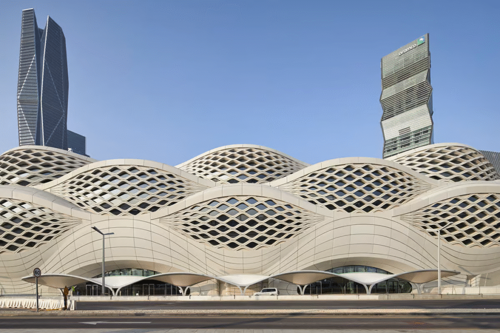
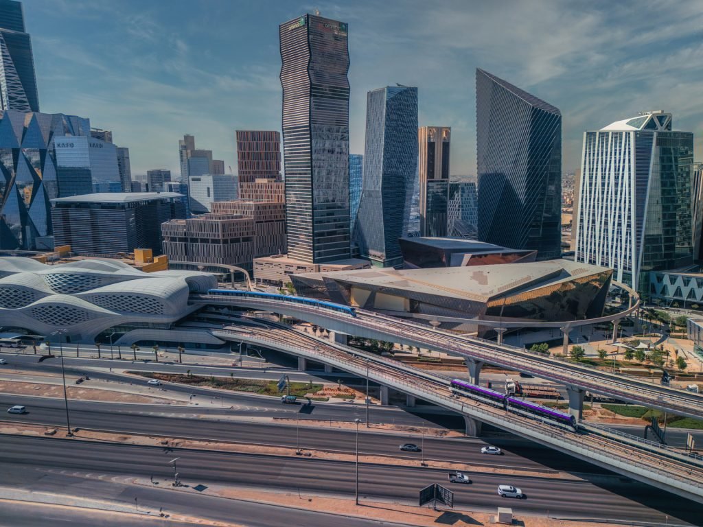
How to Use the Riyadh Metro Map?

Traveling around Riyadh becomes easy once you grasp the Riyadh Metro Map. The map is structured with various colored lines, each with a metro line route.

The colors enable passengers to easily know which train to board and where to change.

Riyadh Metro Map Tips

Tips for First-Time Users of the Riyadh Metro Map

If you’re new to the Riyadh Metro, the map can be your best travel guide. Here are a few easy tips to help you get started:.

With these tips, even first-time riders can easily explore Riyadh without confusion.

Key Metro Stations on the Map

Riyadh Metro is planned with a number of landmark stations that serve as major gateways throughout the city. These major metro stations are not merely termini; they are significant places that link passengers to business hubs, residential areas, shopping malls, cultural centers, and even airports.

Some of the major stations are:

Zaha Hadid Metro Station

an architectural wonder that has become Riyadh's modern icon.

Downtown Central Station

located at the city’s heart, linking commercial and residential zones.

Airport Link Station

a direct connection to King Khalid International Airport for travelers.

These stations, along with others across the network, make it easier for residents, workers, and tourists to navigate Riyadh with speed and convenience. In the next sections, we’ll take a closer look at each of these major metro stations and their significance.

Metro Map

Ready to Explore Riyadh Metro?

Whether you’re planning a daily commute, heading to the airport, or exploring the city’s landmarks, the Riyadh Metro makes every journey faster and easier.

Check the full Riyadh Metro Map and start planning your route today!

Riyadh Metro – Your Smart Way Around the City
Skip the traffic, save time, and travel affordably with Riyadh Metro. Modern trains, cool stations, and clear routes make it the easiest way to explore the city—whether for work, study, or leisure.

Quick Links

Home

Metro Map

How to Ride

About Us

Blog

Company

About Us

Career

News

Media Kit

Contact

Terms & Conditions

Resources

Blog

Newsletter

Events

Help Centre

Tutorials

Support

© 2025 Riyadh Metro Info. All Rights Reserved.Royal Elementor Addons